
DWG collaborates with DOC to conserve sea lions
Published: 26 March 2018
Scientists are using GPS technology and remote cameras to help them to better understand how to prevent New Zealand sea lion pups dying on Campbell Island.
They also tested the use of a drone to count sea lions and grey-headed albatross, and to produce aerial maps of their colonies.
Campbell Island is 700 kilometres south of Invercargill.
The Deepwater Group (DWG) and Department of Conservation (DoC) are collaborating on the project to better understand how to mitigate threats to pups – such as disease and drowning or starving in holes – with initial results promising.
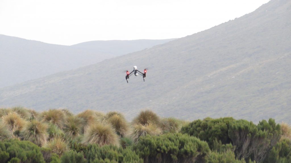
Trialling drones for mapping terrain and animal colonies © Deepwater Group
There were 734 pups born at Campbell Island over the 2017-18 summer, an increase on the 696 counted during the previous survey in 2015.
Survey numbers indicate pup mortality was at 23 percent this year, a significant decrease from 58 percent in 2014-2015 – the last time the population was monitored.
DWG chief executive George Clement said, “It has become clear that the major loss from this population is now pup and juvenile mortality. We need to do all that we can to minimise these pup deaths to help the overall population, which is why DWG is supporting this programme on Campbell Island.”
It is the first time a team has been back down to monitor sea lions on Campbell Island since 2014-2015, and through the New Zealand sea lion/rāpoka Threat Management Plan this population will be monitored and supported annually for at least the next five years.
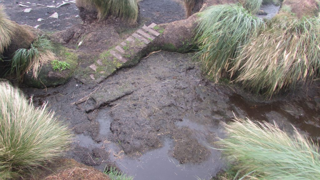
‘Good’ vs ‘bad’ breeding grounds, and an example of a ramp being used to assist pups out of muddy holes © Deepwater Group
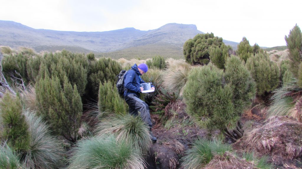
The project set up cameras around mud holes and creeks to monitor the pup behaviour, and GPS technology was used to track pups around the colony.
An engineer and drone technician then returned to the island, having been informed by the GPS and video collected from the first trip, to identify practical solutions for mitigating pup mortality from these holes.
“The information collected and the engineer’s recommendations will help better identify what is causing these deaths, how to prioritise solutions that will have the greatest impact, and what those solutions could look like, such as putting ramps in mud holes for pups to climb out on and creating barriers to prevent pups from falling in,” DOC science advisor for marine species and threats Dr Laura Boren said.
“It has been a real collaborative effort so a huge thanks to all involved. Without the support of commercial fishermen, through DWG initiating and funding the project, the Royal New Zealand Navy providing transport, Fulton Hogan providing their engineering expertise, Zeffa Media providing their drone expertise, as well as to the other volunteers, this project would not have been possible.”
Here is an example of how the drone footage is being used to map the terrain:
3D map of terrain from drone footage at Davis Point © Zeffa Media Acquisition